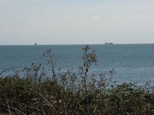
Sunday, October 22, 2006

Fungus on Bisley Green

For those who want to read about my ppl flight training in Naples Florida, see the February archives.

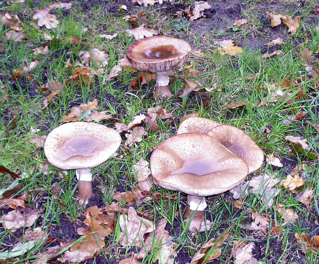
It is a typical dull and damp autumn Sunday afternoon so I thought I would update my blog. I took some pictures of fungus this afternoon when walking the dog. The route takes us across Bisley Green. At this time of year there is always plenty of fungus sprouting and often I see eastern Europeans picking it early in the morning so that they can sell it to local restaurants. I’m not sure whether this regular picking is doing permanent harm. Time will tell.

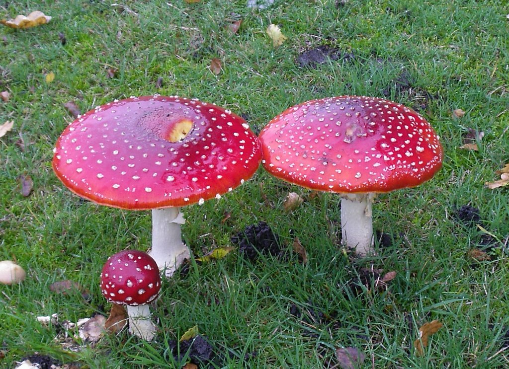
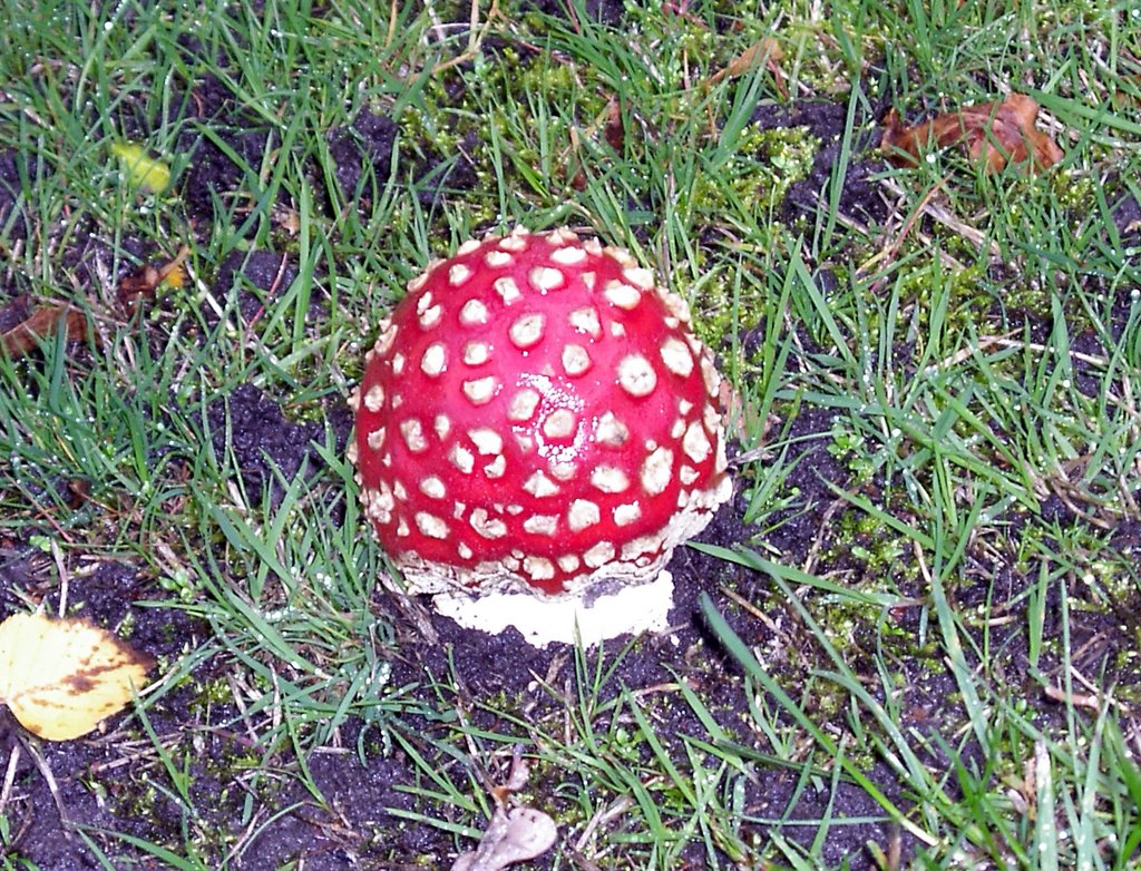
These are ones they would not pick because they are poisonous.


A family of toadstools


A baby one


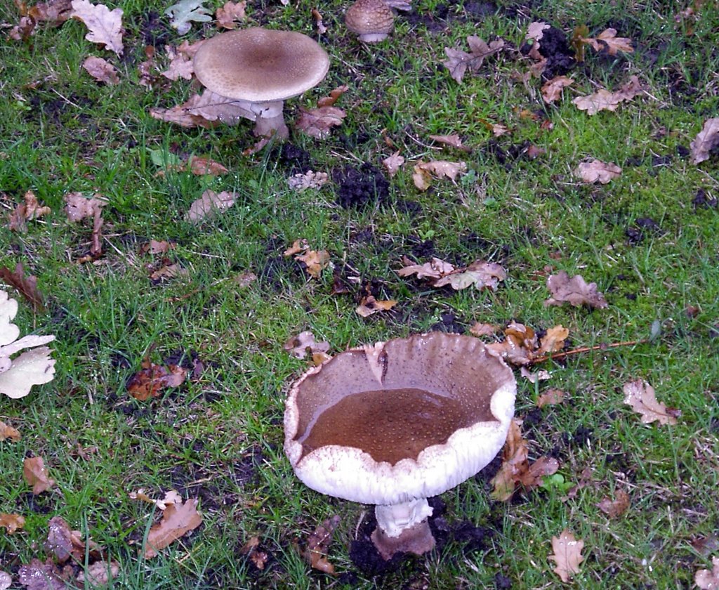
This variety like the rain


Plenty of them around


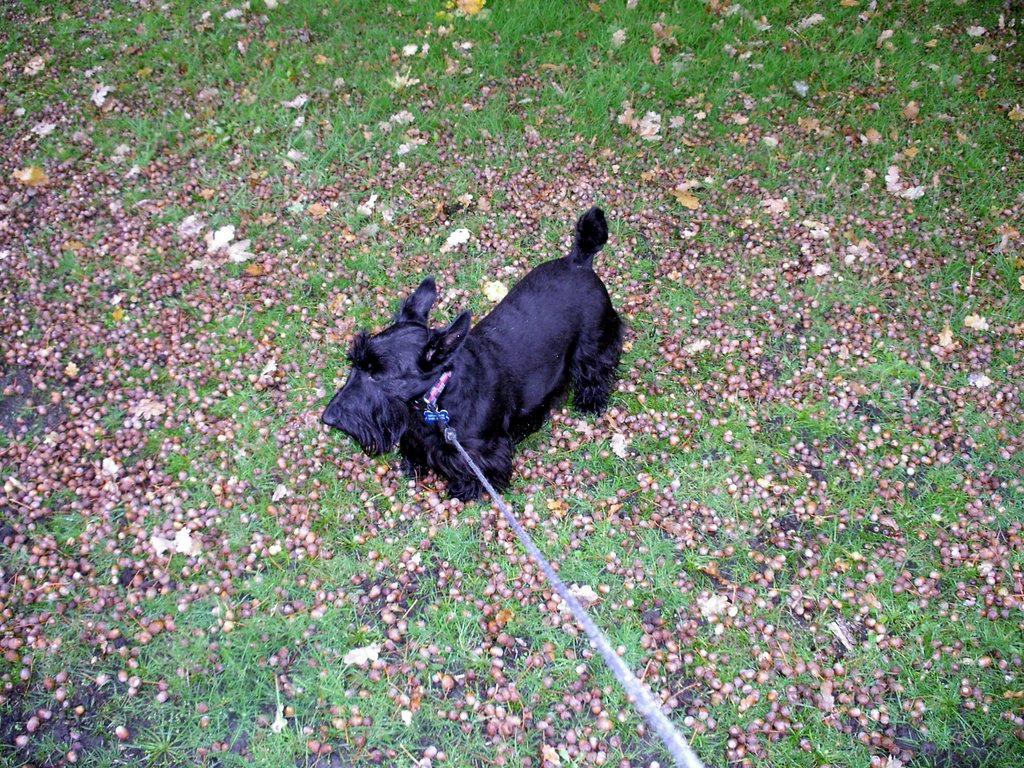
This is not Fungus, its Angus under an oak tree on Bisley Green. We have had a massive crop of acorns this year.


A year ago I went to the Spa GP in Belgium. The point of me telling you this will become clear in a moment. By the way there was no Spa GP this year, but it is back on the calendar for 2007.

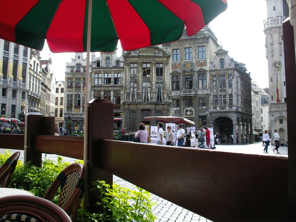
Anyway I stayed in Brussels for a few days during the GP and had some very nice Belgium beer called Leffe Blonde. It has a strong malted barley taste. I took this picture whilst enjoying a glass.


The point is that it is now available in my local supermarket and so I bought half a dozen bottles. Here is one I enjoyed recently.


Here are a few shots from the Spa circuit.


Almost at the circuit


My view for qualifying


Alonso during the race


The podium celebrations at a wet and misty Spa.

The results were, a well deserved win for Kimi Raikkonen, Alonso was second and Button was an impressive third. In fact Button could have made this his first GP win but for a poor tyre choice at a pit stop during the fast changing conditions.

I will be watching the last GP of the 2006 season shortly. It will also be Michael Schumacher’s last race and I for one will be glad that he has gone for next season. It has been rather boring for the last ten years.

Peewit
free web site hit counter

Friday, October 20, 2006

Munchman

For those who want to read about my ppl flight training in Naples Florida, see the February archives.


Today my wife and I have been celebrating our 22nd wedding anniversary. Doesn’t time fly, and it certainly beats my first attempt that lasted 13 years. Hopefully we will keep up the good work.
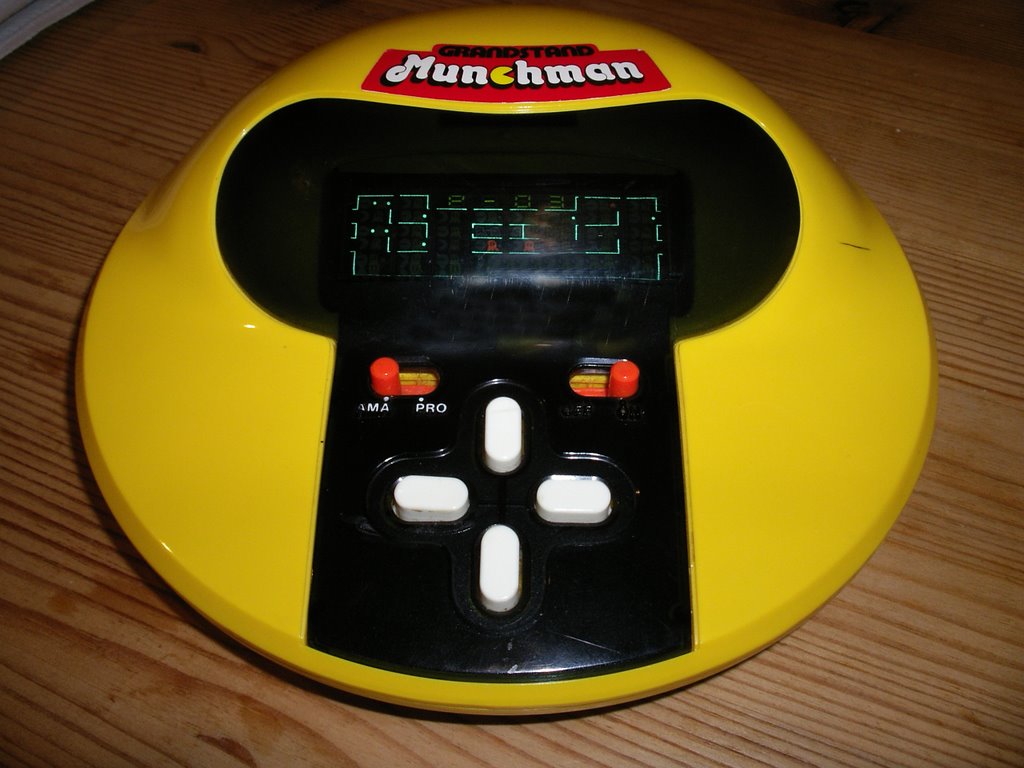
On a different subject, I was thinking about signing up for “second life” (google for it if you have not heard of it) but decided to play Munchman instead. Here is a picture of the kit you need for Munchman.


I have also started trying to deal in shares on-line with a view to making loads of money. You’ll know if it works out when I buy my own aircraft.

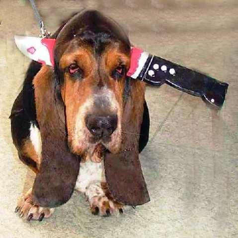
One of my daughters sent me some pictures of why dogs hate Halloween. Here is a picture I particularly like, although I have not shown it to Mrs Peewit.


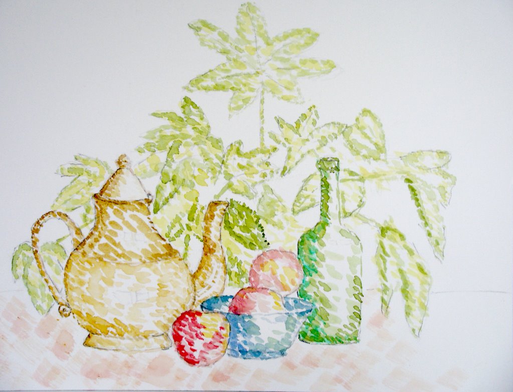
At my art class this week we were given the task of painting a still life using just marks and not the usual watercolour techniques of washes, etc. I have never tried this before and we were supposed to use a square cut brush, but I did not have one and used an ordinary round brush instead. I always start with a sense of fear when looking from the subject matter and down onto a blank piece of paper. Here is my effort as at the end of the two hour session.


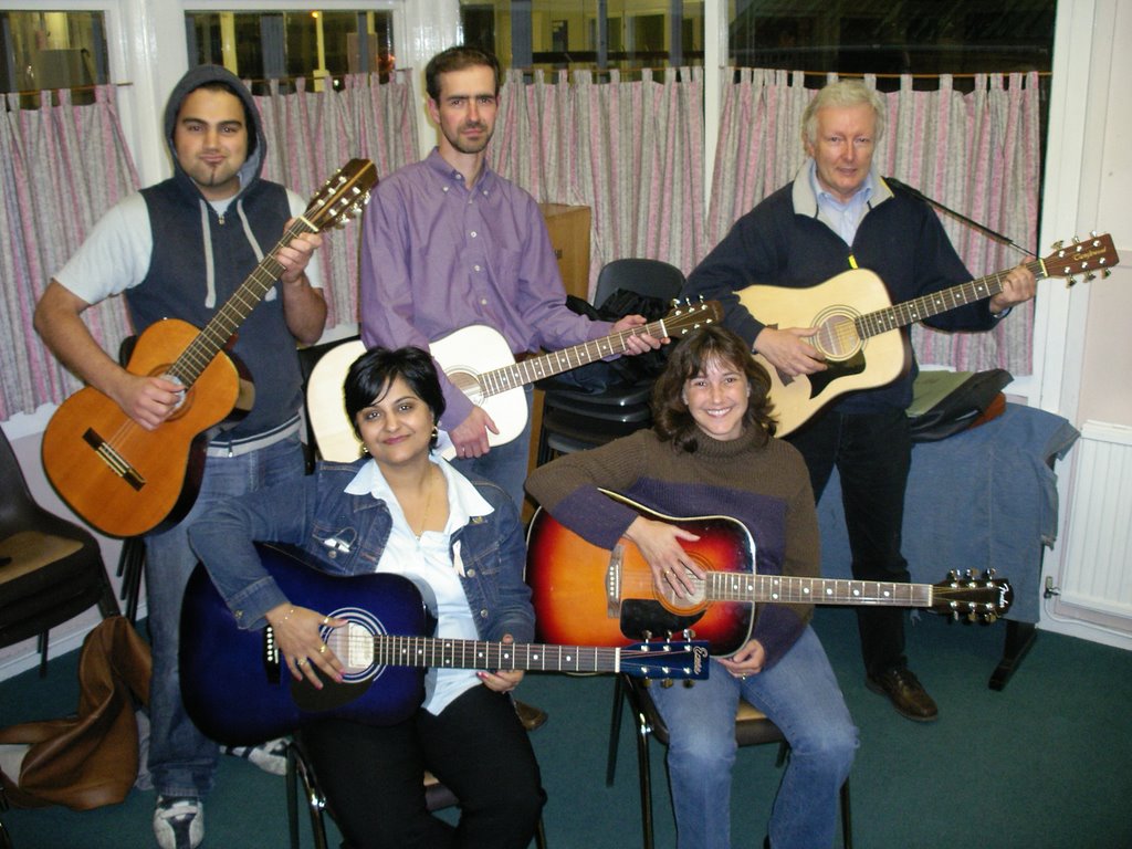
Earlier in the week I attended an absolute beginners guitar class and here is a picture of the five students. I am standing up on the right of the picture.


I am sure that learning to play guitar (for me) is harder than it was to learn to fly. I have not being flying for a few weeks as I have been trying to be a bit more careful about expenditure, but today I have the urge to get back in the air, so as soon as there is a spell of settled weather, I will take a C152 up for an hour of solo circuits. Typically the forecast for the foreseeable future is wet and windy.

All the best

Peewit
free web site hit counter

Wednesday, October 11, 2006

Newlands Corner

Hi everyone

For those who want to read about my ppl flight training in Naples Florida, see the February archives.

I thought I would show you another picture that I painted at my art class. Surprisingly the lecturer does not teach us anything and gives no homework. At the start of each lesson he asks us what we want to do. Some ladies that have been attending his class for a number of years, bring in photos of landscapes and paint them whilst discussing the things that senior
ladies discuss. I am treating this just as an incentive to spend two hours painting where without the formal classroom I would probably not get around to it. This does contrast extremely with the beginners lessons that I attended a couple of years ago. The tutor then was Maggie Hambledon and she taught us technique, checked our work, set projects, gave constructive criticism, provided homework, had a specific agenda and in retrospect did an excellent job.

Anyway here is my latest effort. The blues are a bit too bright.


To see larger images just click on the image and later when you want to return to the text use the "Back" button.

Mrs Peewit and myself were planning a day out at the seaside on Tuesday but when the day arrived it was raining hard. We altered our plans and decided to go for a walk locally if the weather cleared up. Luckily it did so early in the afternoon we drove for half an hour to Newlands Corner. This is on the A25 and is near Guildford. We got parked and into our walking boots. The weather was improving all the time.
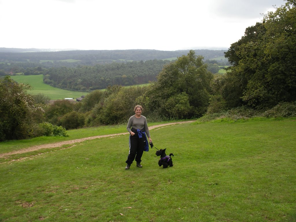
Here is Mrs Peewit and our scottie who is called Angus.


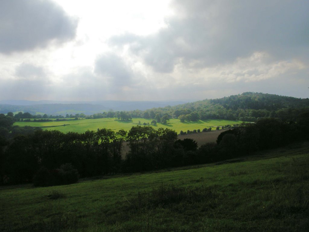
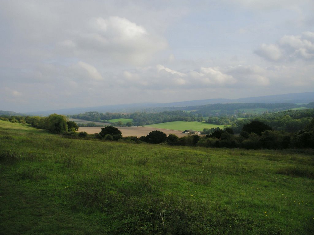
It was amazingly warm for the time of year and although we are into autumn, most of the trees still had green leaves. Here are a couple of the autumn scenes.


After our very pleasant walk across the hilltop and then back through the woods we arrived back at the start point. Here is a map showing our route.


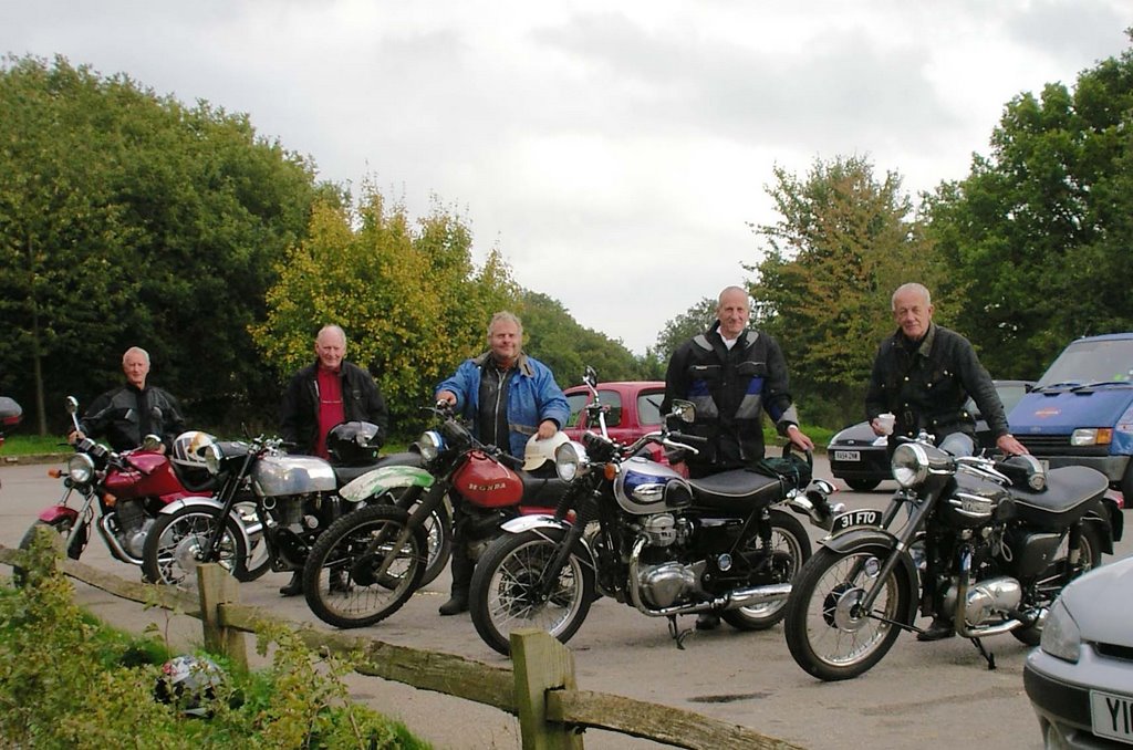
We decided to have an ice cream cornet with a flake each. Whilst enjoying these, I took a picture of some bikers who had come out for an afternoon ride.


The nearest bike is an old Triumph that had the usual pool of leaking oil underneath it.

There are many other walks that start from this spot and we resolved to come back and do some of them. Lets hope that we have a good Autumn.

Peewit
free web site hit counter

Wednesday, October 04, 2006

Weymouth Weekend

Hi all

Last weekend was a special annual event for me.

It was the yearly reunion of a number of ex EMI apprentices.
Yes, each year we meet up at Lawrences’ house in Weymouth and go for energetic walks in the Dorset countryside, talk a lot about what has happened over the last twelve months and go out for a special meal in a Weymouth restaurant.
A lot of years (40+) have passed since we were all apprentices at EMI when we also used to attend Southall Technical College on our sandwich break courses. In those days EMI was a world leading electronics company as well as being the company that managed a lot of pop groups such as the Beatles. I remember well the factory in Blyth Road in Hayes where they pressed out the vinyl 45’s and LP’s. We got staff discounts on these and many other HMV or Morphy Richard items. Myself and others eventually left EMI for new pastures, and those that remained subsequently suffered at the hands of poor company management. The end result is that all the electronic aspects of EMI were sold off and the staff that went into the new companies were eventually given early retirement.
Despite this, five of us have kept in touch and we meet up each year for a pleasant weekend of exercise, fresh air, good food and drink in excellent company.
This year one of our number could not make it. We all send our regards to Tom who is recovering in hospital from a debilitating illness.

Lawrence is the only one who is still working full time, but changes at his company mean that in a year or two he will also have more free time.

Having assembled at Lawrence’s house (minus Brian who had been mysteriously delayed), we tucked into tea and toasted teacakes in preparation for our walk. This was to take place around Portland Bill and as such we were all prepared for wet and windy weather. The Bill is a very exposed part of England’s south coast and the weather forecast was for strong winds and thunder showers.
Lawrence drove us to the start point near the east coast of the Bill. We changed into our walking boots and after I set up my PDA and bluetooth linked GPS unit we set off. In fact the weather was dry and although it was breezy, the wind was quite mild. We were soon approaching the coastline and we passed through a long ago abandoned cemetery.


Here is Lawrence on the left and Chris on the right. We were already removing outer layers in the mild weather.

As we walked along the cliff path we could see teenagers in the bay below. Some of them had decided to walk fully clothed into the sea. It’s amazing what the presence of girls does to teenagers. We were like that once.


As we walked further south the wind got stronger but as it was warm it did not matter. Looking out to sea there was no shipping or boats of any kind. Maybe they were all taking shelter from the rough weather.

At the southern tip of the Bill and near the lighthouse (I did not take a photo as the area is covered in small wooden huts that are part of the Portland heritage but spoil a good scenic view) we arrived at the Lobster Pot café. Here we had a light lunch whilst looking out across the sea. We did see a large vessel on the horizon. It looked like a cruise liner on it’s way up the channel.
After our lunch, we met up with the missing Brian. Lawrences’ wife, Liz had kindly waited for him to arrive and had driven him over to meet us. There had been no mobile phone reception in the café, so that fact that we met up was partially down to good fortune. Brian had a rather lame excuse for his late arrival, but at least he had made it eventually.

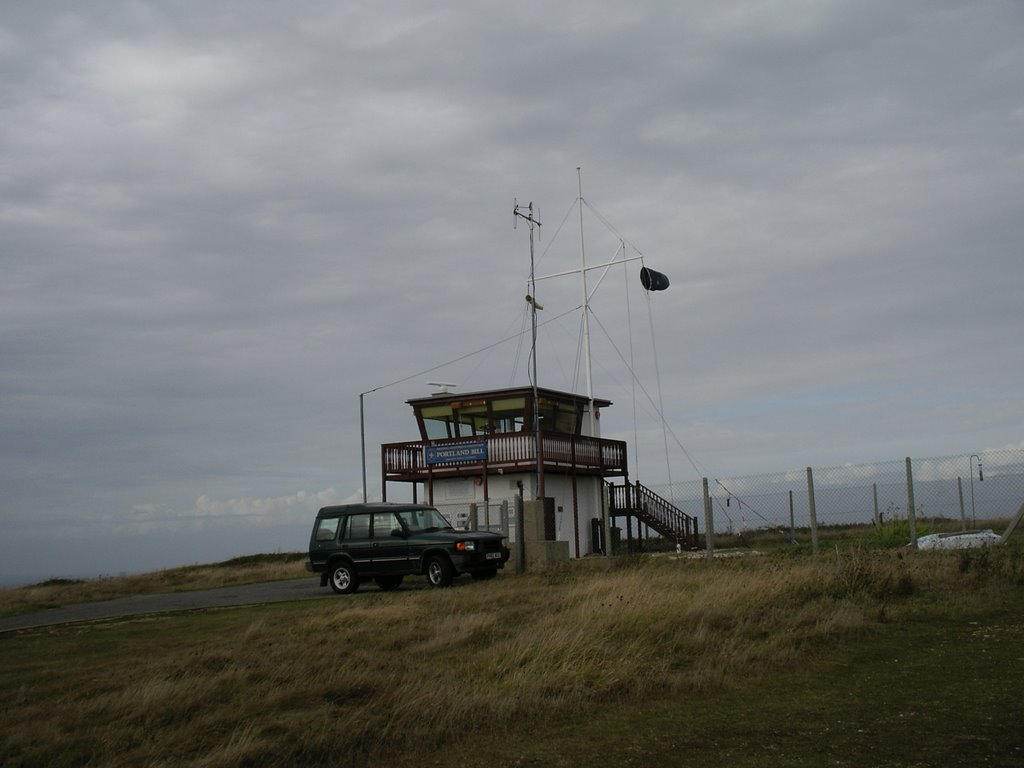
This time the four of us set off on our route up the west coast of the Bill. Amazingly we had avoided all the bad weather and rain. It was still breezy but now the wind was behind us. We passed the Portland Bill coastguard station.


Our pleasant walk continued and eventually we headed away from the coast and were back at the car park. I looked at my PDA and it showed the route we had taken and our altitude and speed profiles. I should have saved the track at this point but instead decided to just switch off the PDA. Annoyingly when I subsequently switched it back on at a later stage it crashed (good old Windows) and I lost the track altogether. Here is a map with the route that I think we took. I hand drew it onto the map. We covered a total of 5 miles on the walk.


I marked the start and finish in green and the track that we took is in red.

We drove back to Lawrences’ house and on the way we passed the place where the dinghy sailing events will take place during the 2012 Olympics.
Liz had organised more tea and cakes (we were being spoilt) and so we enjoyed these and were able to catch up on each others recent activities.

Some time later we needed to prepare for our walk into Weymouth town centre for our evening meal. Suitably changed we set off down the hill into the town. We were dining at Vaughan’s in Custom House Quay. One of Weymouths’ claims to fame is that the Black Death was introduced into England here in 1348. Apparently on the wall of the restaurant there is a plaque commemorating the arrival of the plague in the port. I did not notice this plaque. It is not often that you get plaque and plague in the same sentence.
We had excellent meals and some Australian shiraz to help it down. Somehow the climb back up the hill at the end of the evening never seems too bad.
Back at Lawrences’ we had more tea and chat before retiring for the night.

On Sunday morning we did not rise too early. The weather was somewhat worse and we were not going to do a long walk as a result. A cooked breakfast soon cheered us all up and the plan was to drive to Poundbury and spend some time there. Poundbury is an unusual place, and here is a description from a website.

“Poundbury is a mixed urban development of Town Houses, Cottages, Shops & Light Industry, designed for the Prince of Wales by Architect Leon Krier on the outskirts of the Dorset County Town of Dorchester. Prince Charles, The Duke of Cornwall, decided it was time to show how Traditional Architecture and Modern Town Planning could be used in making a thriving new community that people could live & work in close proximity. Poundbury has now become World Famous as a model of urban planning, with regular visits from Councillors and MPs.”

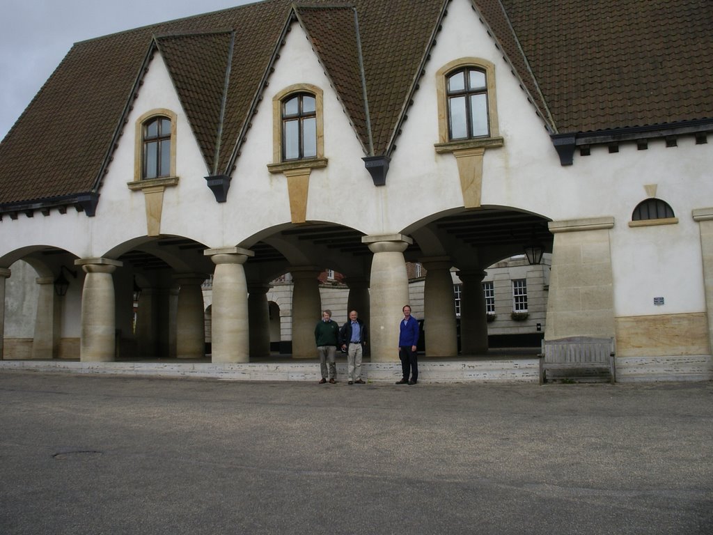
As it was very windy and likely to rain this seemed like an interesting place to visit. We parked in the town square and here is a picture I took of my colleagues.


We walked around the town and it did seem well designed and a good place to live, but at the same time it was very quiet and sterile. The town is only about ten years old and is still being built so it will improve with age. Here is another photo of one of the streets.


After our tour around we headed off to the local garden centre that was housed in an old building. The plants were all getting rather blown about by the gusting wind. We decided to have coffee in the Engine Room café. Even though it was approaching 1pm, none of us were hungry after our delicious cooked breakfast.

Later we returned to Weymouth and indulged in more tea, sandwiches and cake. We all had a lot to talk about but by late afternoon it was time to depart for our homes. It had been a really good weekend but my journey home was spoilt by yet more holdups on the M3. The standard of driving seems to have reached an all-time low, and you can see how most drivers aggression and selfishness leads them into trouble.

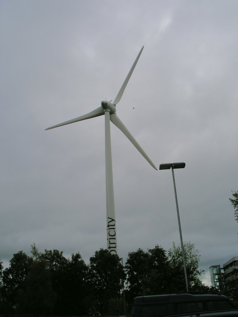
I have not forgotten those with an interest in General Aviation. On the Friday before my visit to Weymouth I was in Reading and took this photo of a wind turbine that is near to the Madejski Stadium.


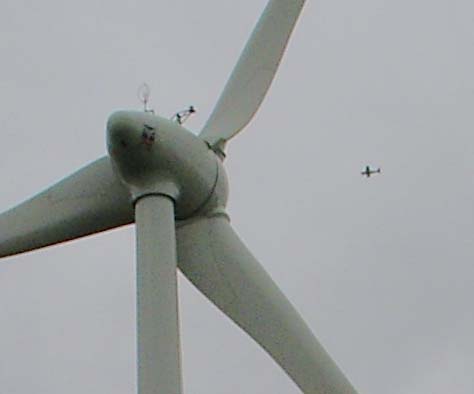
If you now look at this zoomed in picture you can see a small aircraft heading straight for the centre of the sails. I reckon there must be strong magnets in the turbine and the aircraft was in a kind of tractor beam. I never did see it fly away so it must be stuck to the centre of the turbine.


Be in touch again soon.

Peewit
free web site hit counter

Sunday, September 24, 2006

Circumnavigation of the world ?

Hi all, my post is off topic, so is not related to GA this time.

Autumn is approaching and last week I started my adult education classes. I have enrolled for two classes. One is ‘guitar playing for beginners’ and the tips of my fingers on my left hand are rather sore from trying to press down the steel strings against the frets. The other is a watercolour painting class. I did do a beginners class in watercolour a couple of years ago but have not done any painting since then. I am keen to get going again and would like to develop a loose and fast style. I must admit that I want to be able to complete a painting in a couple of hours and a previous attempt at oil painting showed that using oils tended to mean that paintings took weeks rather than hours.
Here is the picture that I painted on my first lesson last week. I made loads of mistakes but enjoyed the experience and will hopefully have learnt something.


On Friday I visited the Southampton Boat Show with an ex work colleague. Having had a good month for weather so far, it broke on the day of our visit. We were lucky enough to have a look around the pontoons at the hundreds of display boats before the rain started. Once the rain got going though it just got heavier and heavier. Despite the rain we enjoyed our look at the exotic hardware available for those with large bank balances. My friend owns a Broom motor cruiser and so was able to provide expert comment on many of the exhibits. Among the boats we went on-board were a lifeboat and a Nordhavn 40. I really liked the Nordhavn as it was a trawler style motor cruiser. In this boat you could circumnavigate the world in reasonable comfort as it is really rugged with a completely enclosed helmsman cockpit. The engine is de-tuned for reliability and the range on full tanks is 2500 miles so enough to cross all the oceans with fuel stops at convenient islands. The boat was not as expensive as many because it is made in Asia. I quite fancy the idea of cruising around the world in one of these boats. Only problem is that Mrs Peewit gets seasick on a millpond. Here is a picture of a Nordhavn.


The lifeboat was very interesting and obviously designed for safety and functionality first, but it looked reasonable comfortable for the crew.

I had intended to take loads of photos but somehow the combination of rain and the distraction of the exhibits made me forget about all those photo opportunities. As the rain got worse we headed for the exhibition areas that were under canvas. My friend Leo was researching inflatables and outboard motors as he needs a tender for his boat. We also had a look at some of the gps based navigation software available. Whilst we were under canvas it sounded as if the rain had now become torrential. At 1pm we decided that it was time for lunch and as Leo was a member of the RYA we headed off to the RYA lounge where we enjoyed a cooked meal in congenial surroundings. After lunch we took another tour around the floating display boats. There were some beautiful boats of up to 90 feet in length for the well heeled. We decided to go on board a tall ship called ‘Tenacious’. This is a wooden hulled ship built specifically with disabled sailors in mind. I actually remembered to take a picture of this one.


Our guided tour around the Tenacious was very interesting and we heard about how the ship was built from Siberian Larch that was glued together with epoxy. The ship was built mainly by volunteers under expert supervision. The idea was to build a ship that could have a crew that was a mixture of able bodied and disabled members. Up to eight wheelchairs could be accommodated and there was provision for blind and deaf crew members as well. We were told that in the USA, they just do not allow disabled crew members on their sailing boats. It was heart-warming to hear how many of the disabled public can have the opportunity to go on these sailing adventures to the Med. and across the Atlantic.

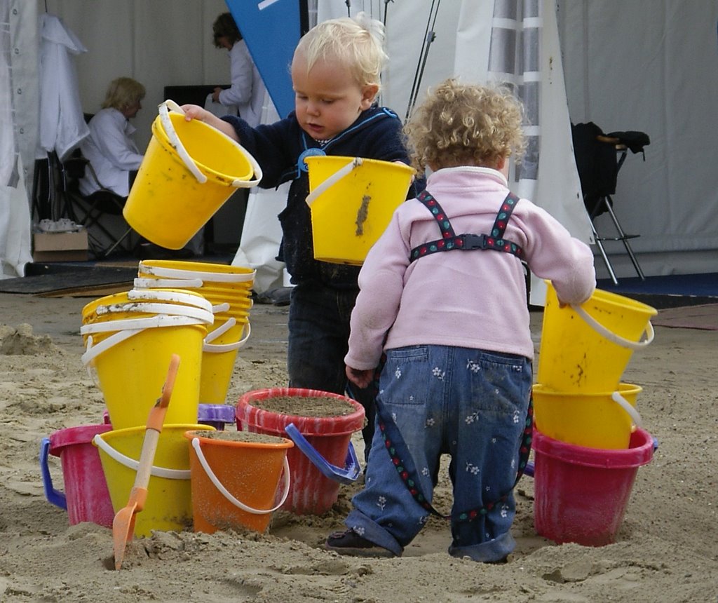
Time for a coffee. We sat near an area where the show organisers had arranged for hundreds of cubic metres of sand to be laid so that children could make sand castles and be entertained by a steel band. The sand and deckchairs were very soggy by now but some children were finding amusement by playing with the buckets.


It was getting late in the day and the rain stopped. We wanted one last look at some of the undercover exhibits before going home. We left at just about 5pm and boarded the ‘Park and Ride’ bus that would take us back to the car. Somebody on the bus said that there were problems on the M3 motorway. We hoped that the problems would have cleared by the time we got off the M27 and onto the M3. The jams were still there and our journey home ended up taking three hours instead of the normal one hour. It had been a good day though and it had re-awakened my long suppressed interest in ocean cruising.

Peewit
free web site hit counter

Saturday, September 09, 2006

EGLK to EGHJ routing

My brief flight to the Isle of Wight took a lot of planning and anticipation on my behalf but I really enjoyed the challenge and the experience.

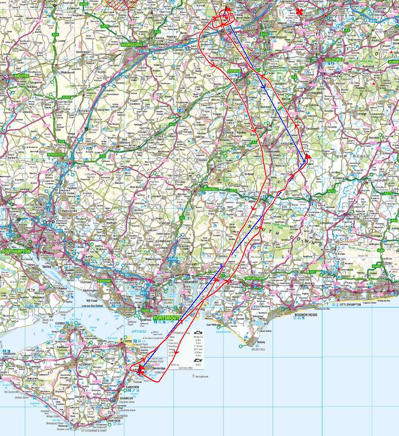
Here is a picture of the route that I actually flew. The track is in red and the planned direct route is blue. I took off from Blackbushe towards the east and landed later from a westerly direction.


If you have Google Earth and want to see the track that I flew from Blackbushe to Bembridge and back last Thursday then right click on the following link and choose 'Save Target As' from the menu. Then change the name of the file being saved from prw2.xml to prw2.kml and click on 'Save' to save the file making sure you know where you are saving it to.
Lastly locate the saved prw2.kml file (you can search for it if you cannot find it) and double click it. This will launch Google Earth and fly to my route.

Route link

HELP NEEDED - If you know of a simpler way of doing this please let me know.

If you do not have Google Earth you can download it with this link.

Google Earth link


Peewit
free web site hit counter

Thursday, September 07, 2006

First UK landaway

Note - Will use a later post for the Google Earth link to my route

I’ve got my PPL and the privileges of having it are that I can fly as captain on a single engined aircraft and even take passengers. Despite these privileges I still feel very much in learning mode. Today I am flying from Blackbushe to Bembridge on the Isle of Wight and returning later. I was determined to wait until some good weather was on the horizon before booking an aircraft. This is because despite having some excellent flying weather over the summer period, I did not manage to fly in any of it. It was mainly due to need to book an aircraft and instructor well ahead whilst I was a PPL student. Anyway, now that is history and on Monday, I booked a Cessna 152 for today in the 9:00 to 12:00 slot. My preference was to go later and have lunch on the Isle of Wight but there was no aircraft availability at that time. On Monday, the weather forecast for the Thursday was good with sunny weather and light winds. During the next couple of days that forecast went right through a loop, passing cloudy and wet along the way. It just goes to show how hard it is to book any kind of weather related event in the UK. Anyway by Wednesday evening it was looking likely to be a nice sunny day with a slightly cooler than recent temperature and a bit of a north wind. On my planned trip there seemed to be so many new aspects to it for me that I decided to try to make a list of the things that I needed to do. The only problem is that many things actually evolve on the day, such as the actual weather, diversions requested by ATC, etc. I did my best to compile a basic list of things to do. As I did all my cross country training in the lovely Florida area with its ample sunshine, I had so far not made a landaway flight in the UK, and this would be my first. So what was I unsure about ?
Well here is part of the list :-
1 The best route to avoid too many air traffic problems.
2 The actual procedure for climbing to overhead Blackbushe to gain sufficient altitude to cross the very near Farnborough aerodrome airspace.
3 When I called Farnborough Radar, would they let me straight across their zone or would I have to divert east or west of the area. I had never flown any of these areas before so it would all look new.
4 I had never followed a radial to or from a VOR before (I had only used them to get a position fix) and how would I get on tracking a radial.
5 They had been carrying out an experiment using specific squawk codes for aircraft departing from Blackbushe, was this still in use.
6 Which aircraft would I be flying.
7 Which runway would be in use at Bembridge and would I have to use the special joining procedure if gliders were flying.
The list just goes on, so I’ll stop here before you get too bored.

At last it is Thursday morning and the skies are clear with the promised cooler northerly breeze. Yipppeeee, I am actually going flying to a nice place on a nice sunny day.
I check the weather and the winds forecasts and up-date my navigation planning log. The route I have chosen was suggested by pilots on a forum in response to a question on routes raised a year ago. The route is to climb out of Blackbushe and then request permission to cross the Farnborough ATZ and head towards the Midhust VOR. And once getting there, to turn onto a direct heading to Bembridge. This route avoids the busy Solent area and also ensures that the run across water is not too long. By crossing at 3000 ft it should ensure that you do not get wet if you suffer an engine failure.

I used the Internet to check the Notams, and also looked at a webcam on the Bembridge airfield where once again it was clear blue skies and sunshine.
Here is the webcam address
http://www.eghj.com/webcam/

I was now ready to set off for the airfield. The traffic was better than I had expected and I arrived half an hour early at 8:30am. I sat around in the car for a while waiting for the offices to be opened. I could see the windsock was actively extended in a direction indicating a northerly wind and about the worst angle of crosswind you can get. A little while later I went into the offices and went through the paperwork to take charge of G-CDTX and also managed to check up on the climb overhead procedure. I booked out the aircraft and myself by phone before walking over to the 152 on the apron.

My mount for the morning


I rang Bembridge on my mobile and determined that it was runway 30 in use and that gliders were not active today. I did the visual checks and walk-around on the aircraft that I knew needed to be topped up with fuel. I also got my PC and GPS running as a backup. Having gone through the interior checks and starting the engine, I could see a problem. The Attitude Indicator (AI) was looking really out of sorts. The display was all moving in different directions and it made you feel sick just to look at it. Hmmmm, what to do now. Well maybe it will sort itself out whilst I taxi over to the fuel pumps. Well it didn’t, so while the fuel was going in I ran over to the offices to report the problem. They said to see what happens on restart, and if there is still a problem to bring the aircraft back to the parking area. Once the tanks were full, I restarted and the AI was still no better. Oh well, taxi back then and shut down the engine again. This time one of the instructors came over and tried to fix it by moving the aircraft about but to no avail. I was given a choice, either do not go, or ignore the faulty instrument that was not needed on the planned VFR flight. It was my decision and I wanted to go. Some sticky instrument covers were fitted so that the lurching instrument was not too distracting. I stopped the engine yet again so I could strain off some of the newly filled fuel tanks to ensure there was no contamination. Eventually I was ready to go, albeit an hour behind schedule and with my head already spinning. The warm up checks went normally and I was soon taking off on runway 07 with that significant crosswind. Once airborne I started the climb whilst sticking to the circuit pattern. I soon requested to change frequency to Farnborough Radar and this was approved. After my dialogue with them I had my allocated squawk code and they asked me to fly to the west of their area. Off I went down towards Odiham and after a while they came on the radio and said that I could now make my turn onto a heading for Midhurst. At this point I realised that I had not set up my PC program to lock the centre of the map to my actual position so I had just flown off the page, and could not start fiddling with it now. So much for the backup.
My plan had been to use the VOR instrument to guide me to Midhurst, but I was not certain of which radial I would be on after my diversion. I persisted and was heading in more or less the right direction, but found that referring to my paper chart was what remedied the situation. Once in the vicinity of the Midhust VOR beacon, I turned onto my new heading for Bembridge. At this point Farnborough Radar completed the Flight Information Service (FIS) they had been providing me. I could actually see the Solent and the Isle of Wight in the distance. I followed my planned heading and could see that it would take me over Hayling Island as expected. I climbed from 2,400ft to 3,000ft and set the radio for Bembridge Radio. The view was good, although slightly into the sun, but hey, this is the best flying weather I ever experienced in the UK.
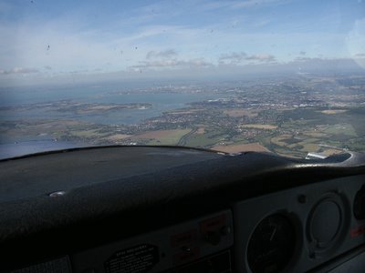
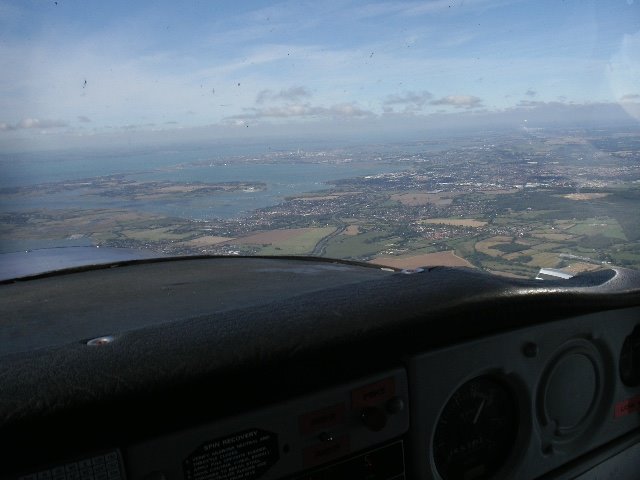
Approaching the South Coast


I can see that large tower at Portsmouth and once I am over Hayling Island there is not long to go. I called Bembridge on the radio and got the runway details and pressure settings. There was a little activity but not much. Once I was halfway across the open water, I request a straight in landing and this was granted. The runway is close to the coastline and I could see it easily. I lost the required altitude and lined up to land. Once again there was a crosswind but not too severe and I must admit that the runway did look small compared to that at Blackbushe. I wafted in over the cliffs and was soon touching down with a healthy amount of rudder to straighten her up just before we touched the runway. Bembridge Radio said “Welcome to Bembridge” and asked me to back taxi down the runway to the concrete taxiway and then to the allocated parking spot on the grass. The whole flight had taken 35 minutes in the air.

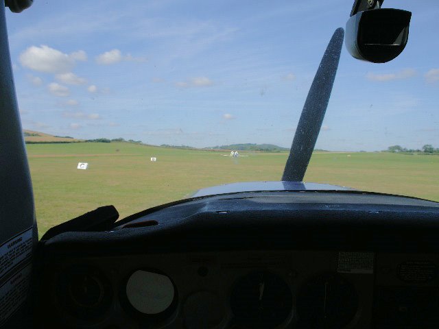
The view from the cockpit having landed at Bembridge
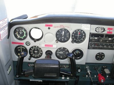


The instrument panel with the Attitude Indicator covered up
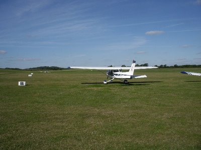


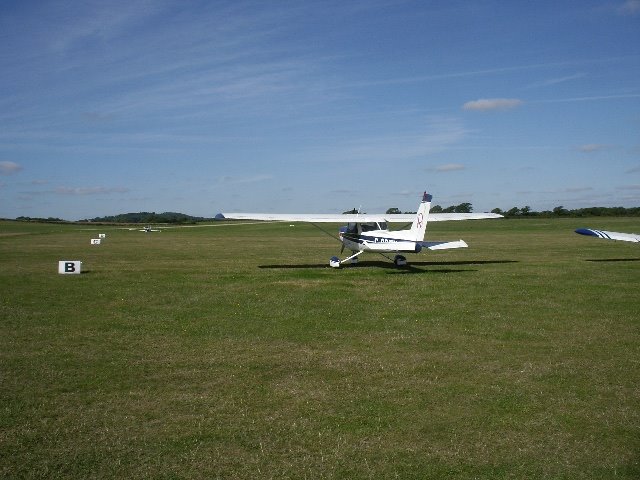
Tango Xray on the field at Bembridge


The airfield buildings


I got everything shut down and secured and walked over to the airport building to pay the very reasonable £5 landing fee. They are very friendly here. It was now getting on for 11am and on my original schedule I was supposed to be back at Blackbushe by midday. I did however want to walk on the beach at Whitecliff Bay, so I set off in that direction.
On the way I heard aircraft coming very low overhead and on looking back I could see the rather uneven runway just a shortway off. It does look as if you have to fly under the electricity cable and narrowly miss the trees on the left in order to land.
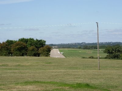
The runway looks odd from this angle


Eventually I got to the cliff edge where it was obvious that there was no easy way down to the beach. I decided to turn left and head along the cliff path to Bembridge.

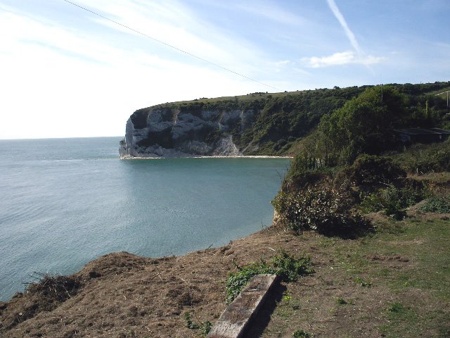
Whitecliff Bay


It was a very pleasant walk and I passed the Bembridge School that seemed very good for outdoor activities with lots of children in suitable protective gear and helmuts, using an aerial runway. In another part of the school grounds there we some children using Go-karts. It wasn’t like that when I was at school.

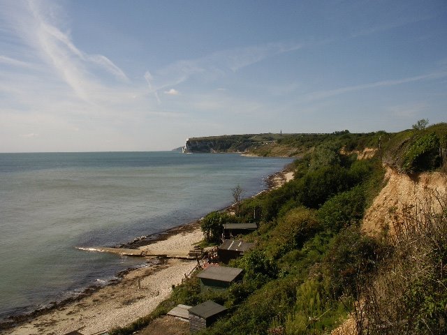
Another view of the bay after I had been walking for quite a time


The cliff footpath did seem to go and on so I started thinking that I would need to get a taxi back to the airfield. At one point there was a sign saying that the path was dangerous and near the cliff edge, but in practice it seemed all very safe, with young children and older people traversing it.
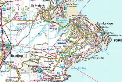
A map of the Bembridge area (it shows the track that I flew)


Eventually the path came to the outskirts of Bembridge and a pub called the “Crab and Lobster”.

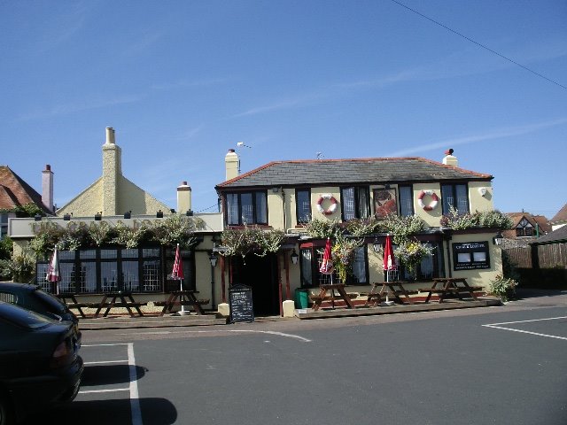
The Crab and Lobster at Bembridge


I was somewhat concerned about being away too long so as it was now 11:40 (and food started at 12:00) I had a glass of orange squash and some crisps. I enjoyed these at a table overlooking the Solent and the next door Coastguards Station.

The Coastguard Station


Looking across the Solent


I then called for a taxi back to the airfield. After a mobile call to Blackbushe to provide a new ETA and the news that the AI was still duff, I booked out and once again returned to the aircraft. This time I got the PC setup properly after completing all the important aircraft checks. I had a bit of confusion about how one should get back to the runway, resulting in me be asked to come back after heading up the concrete taxiway. It turns out that you use a special grass taxiway which I had not spotted as there was an Islander (the aircraft) parked at the entrance to it. Once this was sorted and I had completed my warm up checks, I took off and turned to the right onto a North East heading whilst climbing as quickly as possible. I knew that now I was over the coastline and already at 1000ft, if I had an engine failure, I could always land back at Bembridge. I carried on climbing till 3000ft and levelled out. As I approached the English coastline, the views were absolutely fantastic but I did not feel that I had enough spare free capacity to find my camera and take photos. These images are just locked in my mind. As I crossed the coastline I said bye to Bembridge Radio and just admired the view. I was heading back to the Midhurst VOR and had carried out the water crossing using just my planned heading and that fact that I could see Hayling Island very clearly in front of me. I now tried to make a better job of using the VOR as a means of heading in the correct direction and did better this time. With the northerly wind, progress was slower. At one point I saw a gliders wings flash about two miles ahead and above me. I decided to take evasive action. I surprised that just moments later he was a lot closer and off to my right. You can only really see their wings when they catch in the sunlight and it did give me a bit of a scare. I was expecting to be more or less close to the Midhurst VOR at 13:00 and I was in the right place. I turned onto my new heading and called Farnborough Radar. They gave me height instructions and in effect let me fly directly over the western end of their airfield. So I was soon approaching the M3 and got permission to change to Blackbushe Information. Landing was on runway 07 and there was still the crosswind. I crossed the field and descended on the deadside to the circuit height of 800ft and after turning downwind, was soon back on the ground at 13:15. The flying time on the return leg had been 42 minutes.
I taxied to the parking area and got everything shutdown. The AI had not improved but a replacement had been organised. I completed all the paperwork.
I had thoroughly enjoyed my flight on a beautiful sunny day. The trick will be to reduce the brain workload or at least move some of the new challenges to the back of my brains a bit, as I get used to them.

Hope this has not been too boring but it is the sort of thing I would have liked to have read. Sad really, but I am enjoying myself.

Just in case this flying stuff does not keep me too busy, I have just enrolled for water colour painting, and guitar playing classes. I think that getting music out of a guitar could be my biggest ever challenge.

Regards

Peewit
free web site hit counter